 Hampton County was created on February 18, 1878 by an act of the South Carolina General Assembly that cut away the northern portion of Beaufort County creating the 33rd county of the state’s 46 counties. The county was named for statesman and soldier, General Wade Hampton, III, who was elected governor of South Carolina in 1876.
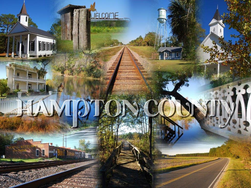
Shortly after, Miles B. McSweeney founded The Hampton County Guardian newspaper in 1879 before going on to become the only county resident ever to serve as Governor of South Carolina.
On 1769 maps, Beaufort District was subdivided into three parishes: St. Peter’s, St. Luke’s and Prince William’s. Most of Prince William’s Parish is now Hampton County. Another name for the northern part of Beaufort was Lincoln County, which eventually became Hampton County.
In 1868 the county seat of Beaufort County was relocated from Gillisonville, which was near the center, to the Town of Beaufort. This created greater distances for many of the county residents to travel in order to conduct county business thus creating a hardship. The State Legislature was petitioned to allow a new county to be formed, giving birth to Hampton County
Since these citizens were breaking away for the purpose of having their own courthouse, it was important to seat the new government in a place convenient to all. Voters chose the geographic center of the new county, but when it was surveyed, the center was found to be a large cypress pond surrounded by swamp. In a second referendum, Varnville won the county seat race and commissioners determined the new courthouse could be situated within two miles of the town that won the referendum. The center of the courthouse was placed exactly two miles from the Varnville Depot. The well-worn brass top of the surveyor’s benchmark may still be seen in the center of the main corridor in the Hampton County Courthouse. Officially identified as the Town of Hampton Courthouse, the town was incorporated December 23, 1879 as Town of Hampton.
In 1912, a strip of Beaufort County and a southwestern slice of Hampton County were joined to form Jasper County. In 1919, Hampton County was again reduced in size when the northernmost tip was cut off and added to a piece of southern Barnwell County to form Allendale County
Today’s Hampton County was originally mapped as “Indian Lands.” Yamasee and Creek Indians, migrating from Florida, and others had trading posts, trails, burial grounds and ceremonial grounds throughout the pinewoods and swamplands. Numerous Indian names remain: Salkehatchie, Coosawhatchie, Huspah, Caw Caw and Combahee.
Hampton County did not escape the ravages of war, its lands seeing action in the Yamasee War, Revolutionary War and Civil War. General William T. Sherman’s Union troops cut a three-pronged swath of destruction through Hampton County on his march from Savannah, Georgia to Columbia, South Carolina.
Historical Markers
Hampton County Courthouse
Elm Street East
Hampton, SC
All Wars Memorial
Courthouse Square, First St. West Side
Hampton, SC
Town of Brunson
686 N Railroad Avenue
Brunson, SC
Miles McSweeney Home Site
Regions Bank
403 First Street East
Hampton, SC
Prince Williams Baptist Church
Pond Town Rd, right on Prince Williams Rd.
Brunson, SC
American Legion Hut
Hoover Street S and Jackson Avenue W
Hampton, SC
Whippy Swamp Muster Ground
Harmony Presbyterian Church
Bamberg Highway
Hampton, SC
Plywood Plastics Corporation
Westinghouse Micarta Division
Hoover Street North
Hampton, SC
Lawtonville Baptist Church
194 Fourth Street East
Estill, SC
Estill Presbyterian Church
343 Clark Street
Estill, SC
Hampton Colored School
725 Holly Street West
Hampton, SC
Morrison Academy
Lawtonville Cemetery, Old Orangeburg Road
Estill, SC
Sherman’s March from the Sea
Intersection Pocotaligo Road/ Highway 601 S
Hampton, SC
Lawtonville Church (Circa 1884)
Augusta Stagecoach Road North of
Crab Orchard Road
Estill, SC
Hermitage Plantation
On Federal Correctional Institution Property
Estill, SC
Steep Bottom Baptist Church
2035 Steep Bottom Road
Estill, SC
Huspah Baptist Church & School
105 Hoover Street North
Hampton, SC
Davis Swimming Pool and Airport
1395 Shirley Road
Garnett, SC
Gifford Rosenwald School
6146 Columbia Highway
Gifford, SC
Yemassee Rosenwald School
131 Yemassee Highway
On Fennell Elementary Property
Yemassee, SC
Estill Rosenwald School
555 3rd Street West
Former Estill Training School
Estill, SC
Brunson Rosenwald School
483 N Broad Street
Former Allen Elementary
Brunson, SC
Hickory Grove Baptist Church
125 Hickory Grove Road
Brunson, SC
Cherry Grove Christian Church
1895 Cherry Grove Road
Brunson, SC
James Washington Moore House
503 Oak Street West
Hampton, SC
WWII POW Camp
Hampton Elementary School Property
Hampton, SC
Bank of Hampton
Town of Hampton Museum
15 Elm Street East
Hampton, SC
Lucile Ellerbe Godbold
M. L. King Boulevard between 4th & 5th Streets
Estill, SC
Site of Hampton High School 1911-1954
408 Mulberry Street
Hampton, SC